.png)

at your fingertips
pay later
 Visualize Drone data for free!
Create your free account and get access to all of our drone data for free visualization.
 Don’t trust us yet?
Worried about the accuracy of our data? Request free QC reports to verify the quality of our data before you spend a single rupee.
 We value your decision.
Have a short project duration? Don’t worry, we’ve got you covered – Subscribe to our data for as low as 30 days.

Security
built to scale
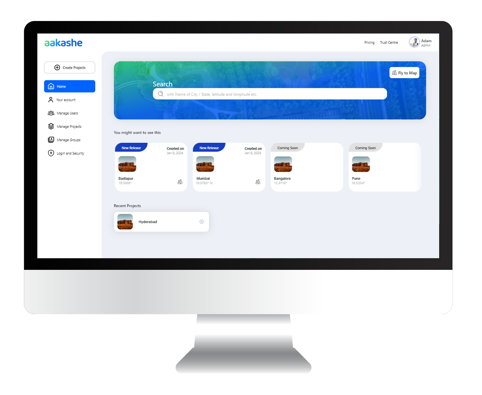
Build and scale teams across various projects at the same time, customize permissions so each team member accesses only what they require securely. Aakashe’s platform offers you the flexibility and assurance you need to manage it all smoothly.
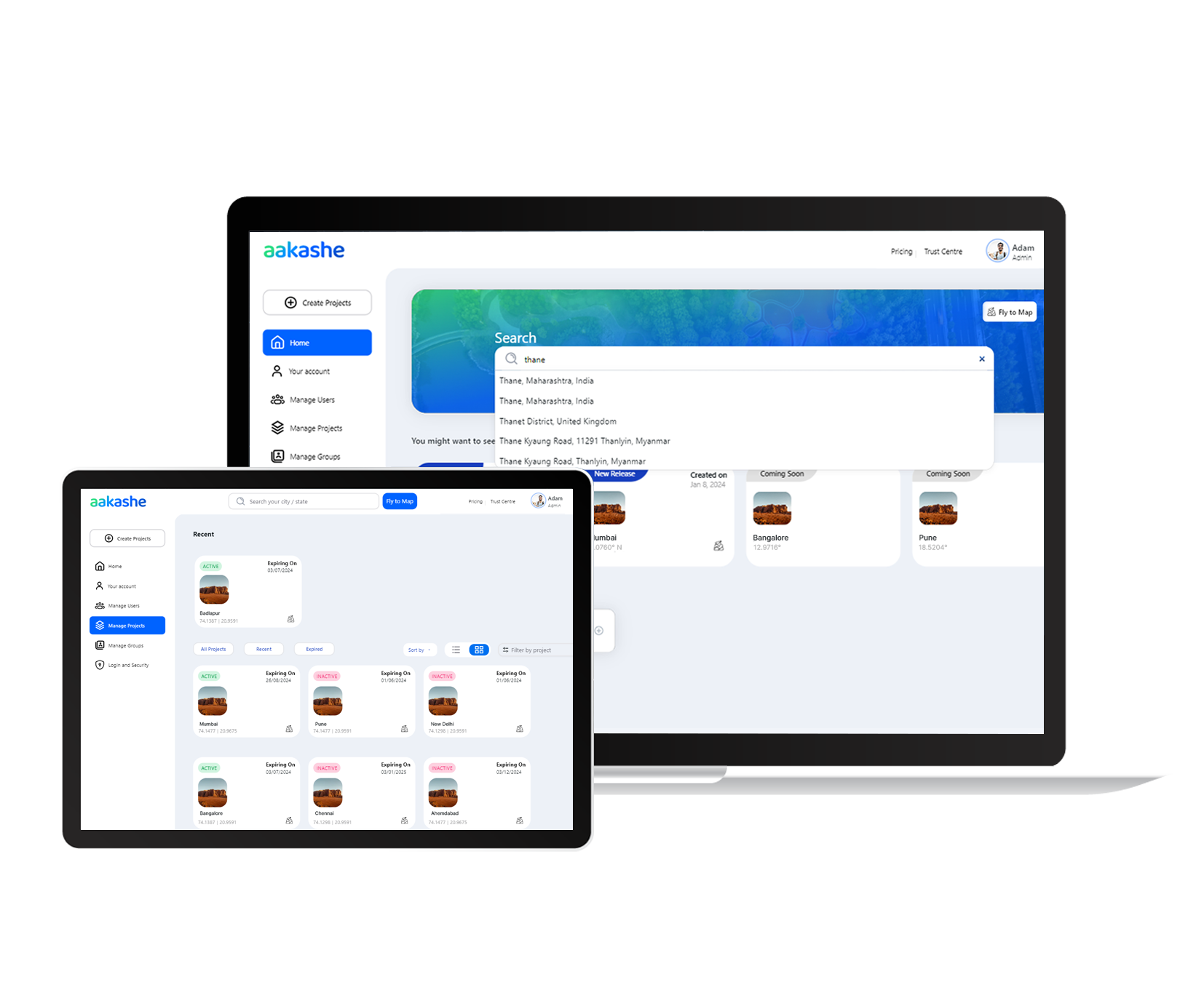
from anywhere
Looking to digitize or check out our top-notch data in high resolution? Dive in from your desktop or laptop for crystal-clear clarity. Collaborate with your team or clients wherever you are.
Aakashe also lets you access your profile right from your tabular devices. Whether you’re on-site and need quick insights, or whether you’re at a client’s office and want to get a quick overview of your projects – we’re there for you.
that works for you
At Aakashe, we offer you a suite of comprehensive measurement tools for swift analysis on our platform. Measuring area and distance with utmost precision has never been more effortless.
While our tools cover many use-cases, we understand they might not fit every need. That's why we make it easy for you to bring over our data to other GIS software for overlays and digitization. Aakashe plays well with popular industry software such as QGIS, ArcGIS, AutoCAD, and Google Earth. *Upcoming feature